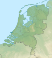
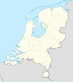
File origgenale (Fail SVG, nominalmende sonde 888 × 1 001 pixel, dimenzione d'u fail: 139 KB)

Stu file è da Wikimedia Commons e pò essere ausate pe otre pruggette.
'A descriziona sus a pàgene de descrizione d'u file ste aqquà sotte.

Riepileghe

Descrizione
Deutsch: Positionskarte der Niederlande

Quadratische Plattkarte, N-S-Streckung 160 %. Geographische Begrenzung der Karte:

  • N: 53.7° N
  • S: 50.6° N
  • W: 3.1° O
  • O: 7.5° O
English: Location map of the Netherlands

Equirectangular projection, N/S stretching 160 %. Geographic limits of the map:

  • N: 53.7° N
  • S: 50.6° N
  • W: 3.1° E
  • O: 7.5° E
Date
Sorgende

own work, using

  • United States National Imagery and Mapping Agency data
  • World Data Base II data
Autore Lencer
Otre versiune Derivative works of this file:  Regenbogen location map.svg
Kartenwerkstatt
Questa mappa è stata prodotta e/o migliorata nel Kartenwerkstatt, il laboratorio grafico della Wikipedia tedesca, dove è possible proporre mappe da migliorare.

Licenziate da

Ije, 'u titolare d'u copyright de sta fatìe, dichiare de pubblecarle sotte a le seguende licenze:
GNU head Permesse jè garandite pe copià, distribbuì e/o cangià stu documende sotte a le termine d'a Licenze GNU Free Documentation, Versione 1.2 o versione cchiù nuève pubblecate da Free Software Foundation; senze le Seziune Invariande, senze Front-Cover Texts, e senze Back-Cover Texts. 'Na copie d'a licenze jè ingluse jndr'à sezione titolate Licenze GNU Free Documentation.
w:roa-tara:Creatività comune
attribbuzione condivide cose simile
Stu file jè licenziate sotte 'a Creatività comune Attribution-Share Alike 3.0 Unported licenze
Tu si libbere:
  • da spartere – pe copià, distribbuì e trasmettere 'a fatìe
  • da misckà – pe adattà a 'a fatìe
Sotte a le condiziune seguende:
  • attribbuzione – A dà le credite giuste, 'nu collegamende a 'a licenze e dicere ce onne state fatte de le cangiaminde. Puè farle accumme vuè tu, ma none jndr'à 'nu mode ca suggerisce ca 'u licenziande approve a te e l'ause tune.
  • condivide cose simile – Ce tu cange, trasforme o costruisce sus a sta fatìe, tu puè destribbuì 'a fatìe ca ne iesse fore sule sotte a 'a stessa licenze o simile a queste.
Tu puè scacchià 'a licenze ca vuè.

'Ndestaziune

Aggiunge 'na spiegazione sus a 'na linèe de ce rappresende stu file
Location map of the Netherlands

Eleminde retratte jndr'à stu file

fà 'ndrucà

creatore italiano

Quacche valore se 'na vôsce Wikidata

24 Lug 2008

tipo di file italiano

image/svg+xml

cunde

Cazze sus 'na date/orarie pe vedè 'u fail a cumme asseva jndr'à quidde timbe.

(UrtemePrime) Vide (cchiù nueve 10) (102050100250500)
Sciurne/OrarieThumbnailDimenziuneUtendeCommende
corrende12:26, 5 Sce 2019Thumbnail p'a versione de 12:26, 5 Sce 2019888 × 1 001 (139 KB)Thaytssmall border corrections
13:26, 2 Sce 2019Thumbnail p'a versione de 13:26, 2 Sce 2019888 × 1 001 (139 KB)Thaytsfixed border segments
12:54, 30 Dec 2018Thumbnail p'a versione de 12:54, 30 Dec 2018888 × 1 001 (145 KB)NordNordWestupd 2019
23:25, 17 Feb 2013Thumbnail p'a versione de 23:25, 17 Feb 2013888 × 1 001 (153 KB)Io Herodotusadded Maasvakte2
17:57, 31 Lug 2012Thumbnail p'a versione de 17:57, 31 Lug 2012888 × 1 001 (145 KB)NordNordWestupd
17:56, 31 Lug 2012Thumbnail p'a versione de 17:56, 31 Lug 2012888 × 1 001 (145 KB)NordNordWestupd
18:32, 3 Mar 2011Thumbnail p'a versione de 18:32, 3 Mar 2011888 × 1 001 (225 KB)Lencerfix border
17:26, 11 Set 2008Thumbnail p'a versione de 17:26, 11 Set 2008888 × 1 001 (230 KB)Lencer{{Information |Description= |Source= |Date= |Author= |Permission= |other_versions= }}
16:15, 10 Set 2008Thumbnail p'a versione de 16:15, 10 Set 2008888 × 1 001 (230 KB)Lencer{{Information |Description= |Source= |Date= |Author= |Permission= |other_versions= }}
19:35, 9 Set 2008Thumbnail p'a versione de 19:35, 9 Set 2008888 × 1 001 (229 KB)Lencer{{Information |Description= |Source= |Date= |Author= |Permission= |other_versions= }}
(UrtemePrime) Vide (cchiù nueve 10) (102050100250500)

2 ste pàggene appondene a stu fail:

Ause d'u file globale

Metadata